
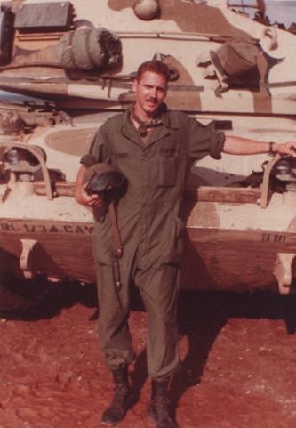
One of the most consistently fun, annoying, and frustrating things about being a retired military intelligence officer is how frequently random military vehicles get called “tanks.” Look, I know, tanks are kind of cool, I get it; I spent a lot of time in them in my career, starting with this vintage M60A1 at Ft. Bliss, Texas. But not everything painted with camouflage that can move is a main battle tank.
So, what are we seeing north of Kyiv that the media has been fixated on for the last several days? What does it mean? Is it a harbinger of the expected siege and fall of Kyiv — 1,000 tanks and artillery pieces? Or is it something else?
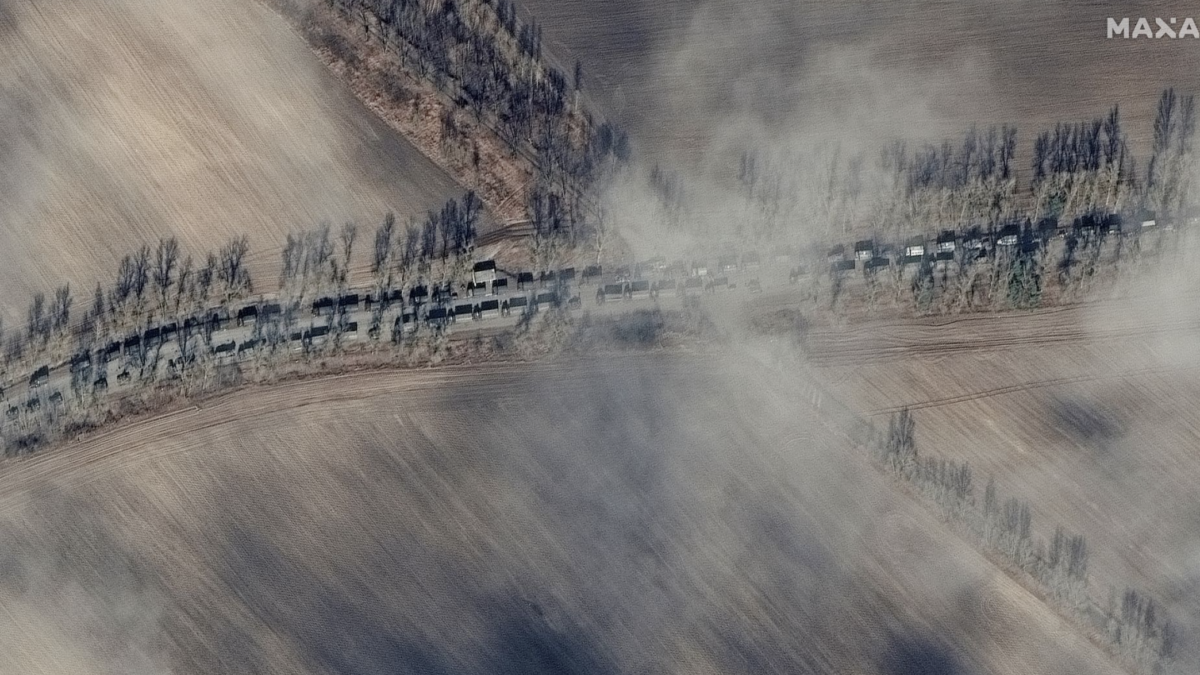
You can tell much about the point of view of the reporter covering this column of vehicles by the degree of alarm accorded it. But the satellite photos, called overhead imagery by intelligence fossils like myself, released by Maxar Technologies show mostly trucks with some local security.
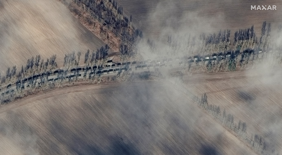
That they’ve been on the road now for as long as four days tells a lot about the operation they are supporting, the terrain, and the leadership and training of the force.
When an intelligence officer regards the terrain on which he is to provide advice to his commander, he conducts a thorough analysis, looking that the size and quality of roads, the capabilities of bridges, chokepoints, and the corridors in which combat vehicles can tactically maneuver.
The roughly 80-mile route from the Belarus-Ukraine border from the Chernobyl salient to Kyiv on the western side of the Dnieper River runs over a secondary asphalt road. This road frequently crosses rivers, runs through small villages, or is bordered on both sides by the eastern extent of the mighty Pripyat Marsh — the geographical feature which defines the border between Ukraine and Belarus.
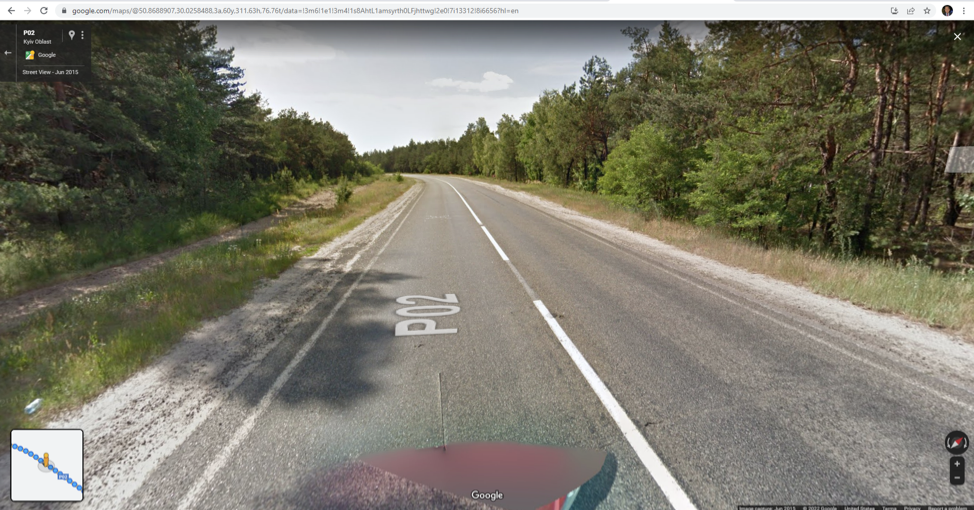
The road is not able to support a large military force, even if unopposed in an exercise, especially during the spring and fall months during a time the locals call “Rasputitsa” — the mud season. Unfortunately for Russian President Vladimir Putin and his military commanders, Ukrainian soil never froze solid this winter, so the fall Rasputitsa is still a factor.
This is why there have been so many photos coming out from the conflict that show all manner of Russian military vehicles bogged down in the mud. As soon as a vehicle on a narrow road becomes disabled or is destroyed in combat, or as the vehicles maneuver off-road in response to combat, they risk becoming mired. Even if they don’t get stuck in the mud, they end up consuming far more fuel that must be delivered to them than they would were the ground frozen solid.
Thus, that 40-mile-long column of “tanks” is more likely mostly trucks carrying fuel, ammunition, and food to the advanced forces of the Russian 20th Combined Arms Army on the outskirts of Kyiv. That this column hasn’t apparently moved much may mean that the Russian forces just north of Kyiv are running low on basic supplies.
This greatly increases the importance for the Russian army to achieve success to the east of Kyiv where the road network is far more developed and, if the terrain is captured and secured, capable of bringing in the volume of supplies needed to properly surround Kyiv and place it under siege.
In the meantime, the forces near Kyiv may be vulnerable to a Ukrainian counterattack. While some of the Russian conscript soldiers and even the veteran contract troops may be more likely to surrender due to low morale exacerbated by a lack of food and fuel.